I was awake half an hour before the alarm and left at 03:15 which was just as well as the tide turned rather earlier than the atlas said and was already running east out of North Ronaldsay Firth which I did not want to go down with all of the tidal races on the eastern end, I also wanted to get north. Very early in the neap flood, with no wind and relatively calm seas, only the odd set of 2 - 3 metre waves were coming through, I kept quite close in to the island where Rosts (potentially dangerous tidal races with over falls, breaking seas etc) often develop.
With little or no wind I continued under engine and once past the island I recalculated the course to steer to clear Fair Isle using my Navpro navigation software and got a strange result, it showed a track hardly deviating from the rhumb line which could not be right with up to two knots of cross tide. If I had used the suggestion I would have run into Fair Isle or even missed it to the south instead of passing well clear to the north. I estimated a course and did some investigation.
There are very few tidal diamonds in the area, although the tidal atlas fills in a lot of the gaps albeit just arrows of varying size without numbers attached. The software interpolates between the diamonds but it became clear that it was taking the nearest diamond but one well to the west of the start point north of North Ronalsay where the tide runs east-west rather than one to the east that runs NE - SE. I continued to eyeball the course from the plotter and ended up steering about 15 degrees north of the recommended course, something to remember on the way back. Update: when I ran several routes east - west the suggested headings and tracks made complete sense.
.JPG) |
| Fair Isle in the distance. On a clear day you are never out of sight of land between Orkney and Shetland. |
On Facebook in real time:
"After 8 hours under engine I’m finally sailing 7nm NE of Fair Isle, I’ll probably have to pay for it later with more engine to keep clear of the Sunbough Rost and more adverse tide further N, but it will be worth it for the quite and lack of vibraton. Wind W 8 - 10 knots, main and chute."
I didn't have to pay more than about 20 minutes under engine when the wind faltered and I went from chute to fore and aft sails and as I headed up to round the Sumbrugh Rost, with good visibility, light winds and some fishing vessels inside the rost I cut the corner a bit with no problems, the tide helping as I closed as it turned from NW flowing to North, the tide was another reason for staying so far south and east on the approach (see the chart below).
.JPG) |
| The iconic view of the Shetlands, Sumbough Head. |
 |
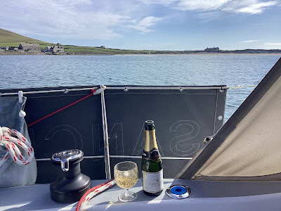
| A celebratory drink for finally getting to Shetland after a serious attempt last year and not being able to "nip over" whilst in Orkney in 2020 or 2021. |
 |
| 61.4 NM in just under 13 hours. |
Click here for Gulber Wick, just short of Lerwick.

No comments:
Post a Comment