Showing posts with label Shetland. Show all posts

Monday, May 12, 2025

2025 May 12th, Day 44. To Grutness Voe.

Disappointing weather today, not so long ago the forecast was for sun all day but this morning it was overcast with early morning (before 09:00) mist. Before I left I was toying with the idea of anchoring for the night at Stova Voe a couple of miles north of here but as soon as I cleared the anchorage I quickly changed my mind, The Bay of Fladdabister is better protected from the SE than I thought, not big waves but not what you would want to anchor in even if you could guarantee being bows on, which would be unlikely given significant changes in wind direction forecast. And it would likely be worse with the waves going up a narrowing channel.

About 40 minutes from Grutness the wind increased from 0 - 3 knots to 5 - 7 and fog came in with visibility down to about 30 yards at times.

30 minutes out.
c 10 minutes out. The modern "broadband" doppler radars are the
bee's knees at short range and even better than this as I got further
in but by then I had things other than photos to concern me.
Fortunately as I got within the Voe the visibility improved so that I could just see both sides and the end from where I anchored, very close to where I did on the way north.

Revised Intentions:


I will be heading to Kirkwall Tuesday / Wednesday for Tescos and fuel. Like my experiance at Lerwick CO-OPs across Scotland and particularly on the islands are still badly impacted by the hacking attacks with reports on a Facebook sailing group of shortages at Tobermory, Tarbert, Stornoway, Brodick, Lochgilphead and Castle Bay Barra.

At economical speed in calm water I should have fuel to motor all of the way to Stornoway with a small reserve. I don't want to motor at all and should not have to with the forecasts showing patchy wind for some days, but I need to be prepared and have a bigger reserve. With only Kirkwall and Stromness possible fuelling stops on route it seems sensible to go where I can get fresh food from Tesco. Till then I'll be living on steak, Gammon, perhaps some spuds (they are chitting), bread (plenty of part cooked baguets on board) and tinned stuff. Life can be hard πŸ˜€.

Models for Thursday lunch time. Saturday and Sunday  may
have fresh N or NE winds but by then I should be crossing
to the western Isles.
An early start in the morning with fog patches likely πŸ˜’ but hopefully some wind, the models indicate F4, that may be on the high side but I live in hope:

Outlook for 12 Hours from 0000 UTC on Tuesday 13 May until 1200 UTC on Tuesday 13 May: North or northwest 3 or 4. Moderate, but slight in waters east of shetland. Fog patches in south and east at first, otherwise fair. Good, occasionally very poor in south and east at first.

14 NM in a little over 3 hours.
Click here for Stronsay.

Sunday, May 11, 2025

2025 May 11th, Day 43. To The Bay of Fladdabister.

Still pics to be added if the computer can recover the corrupt camera disk with my hi-res pics on, fortunately most stuff to Kerkwall and from Eriboll are either OK or backed up to the lap top.

The wind was forecast to be a fresh southerly on Sunday which could make most of the anchorages south of here uncomfortable, so I was considering staying in Lerwick for another day but when I woke there was virtually no wind so I decided to make a quick dash for one of the best anchorages in a southerly, the Bay of Fladdabister and hopefully get there before the wind increased, alas that didn’t work and by the time I was out of the harbour I had 14 knots on the nose and a choppy sea. It was not a big problem, just a bit chilly and slower than hoped and I was at anchor by 08:30.

The anchorage is rather damned by faint praise in the pilot as “rather featureless” but it looks OK to me. There is more motion than I would like in a F4 southerly but not excessive, just not somewhere to ride out a southerly gale and exposed to the east.

Fladdabister.

Intentions.

I will position further south in lighter winds on Monday for the dash to Orkney on Tuesday, I don’t know where I will end up, the most likely possibilities are:
  1. Eastern Orkney, Stronsay or a bit further SW, then through the islands and Eynehallow to Stromness on Wednesday and Thursday, Eriboll on Friday or preferably Saturday if the wind is as per the ECMWF. The (spring) tides favour this.
  2. Pierowall, NW Orkney, then a couple of days moving south, then either direct to Eriboll or via Stromness. Tides are more of an issue with this option.
I’ll have to decide which of the above before I clear Sumburgh Rost as one route goes north of Fair Isle and the other south

Going direct to Eriboll is possible but a very long haul particularly if the wind is light. Pierowell direct to Eriboll is also a possibility but tides are again an issue and it is two long legs in succession.
6 NM in an hour and three-quarters.
Click here for the next days run.

2025 May 9th, Day 41 and 42. To Lerwick

Internet data was pretty dire in Lerwick during the day but was OK in the evenings, probably due to loads of tourists, so a much delayed post...

More still pics to be added if the computer can recover the corrupt camera disk with my hi-res pics on, fortunately most stuff to Kerkwall and from Eriboll southbound are either OK or backed up to the lap top.

Approaching Lerwick harbour.

There could have been an international incident as I arrived. Unknown to me (I'm surprised the Port radio people didn't tell me) celebrations for VE day and the WWII “Shetland Bus” were just ending and 4 of the old fishing boats that took part were about to leave. 

The Shetland Bus was the name given to a group of trawlers that shuttled between Shetland and Norway during the occupation with arms, agents etc. www.liberationconvoy.com (I don't know how long this link will be good for, opens in a new window).

As I turned into the harbour one was mid water just sitting there, and as I was on final approach to the pontoon another cast off and went in front of me, with the first blocking one route out I had to dodge behind the 2nd as he went astern to avoid the first. All slow motion and I was clear by one of my boat lengths but he knew what he was doing and had seen me.

Put the sound on for both these videos and in the second hear a 100+ year old diesel running, all the vessels are restored originals.

2025 The Shetland Bus & VE Day remembrance voyagez

Also present, WWI vintage  Norwegian cargo vessel.
also a Norwegian naval patrol boat.
The locally built "Fifie" fishing boat "Swan"
The original plan was to head up to Muckle Flugga and Saxa Vold but although there was likely to be favourable winds for a day or perhaps two, after that I could easily be weatherbound in Shetland for a long time so I abandoned that idea.

Saturday was a disappointment, after a long walk (for me) I found the fresh food shelves of the large coop almost empty due to the recent hacking attack the group had suffered. They did have a huge amount of chicken pieces but all only had a day or two on the expiry dates, no better than I already had on board. I did get some steak but if I don't berth at Kirkwall or Stromness, that I don't plan to do, I will be on tinned meat before I get to Stornoway or some other place with shops.

4.2NM in 1 hour.

Click here for Fladdabister.

Thursday, May 8, 2025

2025 May 8th Day 40. Grutness Voe to Gulber Wick.

A pleasant sail northwards under the cruising chute, although I did have to motor through Mousa Sound due to a changing wind that came too far forward for the chute, which I had already gybed 3 times in the changing wind.

Entering Mousa Sound.
Mousa Sound and Broch.

Mousa Broch c 300BC and the tallest and best
preserved Broch in existence.
Gulber Wick, chosen for better protection and isolation
of the three bays close to Lerwick.
2025 Gurtness Voe To Lerwick
Grutness Voe to Lerwick
16.6 NM in five and three-quarter hours.
Click here for Lerwick.

2025 May 7th Day 39. Otterswick to Grutness Voe, Shetland.

I was awake half an hour before the alarm and left at 03:15 which was just as well as the tide turned rather earlier than the atlas said and was already running east out of North Ronaldsay Firth which I did not want to go down with all of the tidal races on the eastern end, I also wanted to get north. Very early in the neap flood, with no wind and relatively calm seas, only the odd set of 2 - 3 metre waves were coming through, I kept quite close in to the island where Rosts (potentially dangerous tidal races with over falls, breaking seas etc) often develop.

With little or no wind I continued under engine and once past the island I recalculated the course to steer to clear Fair Isle using my Navpro navigation software and got a strange result, it showed a track hardly deviating from the rhumb line which could not be right with up to two knots of cross tide. If I had used the suggestion I would have run into Fair Isle or even missed it to the south instead of passing well clear to the north. I estimated a course and did some investigation.

There are very few tidal diamonds in the area, although the tidal atlas fills in a lot of the gaps albeit just arrows of varying size without numbers attached. The software interpolates between the diamonds but it became clear that it was taking the nearest diamond but one well to the west of the start point north of North Ronalsay where the tide runs east-west rather than one to the east that runs NE - SE. I continued to eyeball the course from the plotter and ended up steering about 15 degrees north of the recommended course, something to remember on the way back. Update: when I ran several routes east - west the suggested headings and tracks made complete sense. 

Fair Isle in the distance. On a clear day you are never out of
sight of land between Orkney and Shetland.

Leaving Fair Isle behind. In front and to port the fair weather
cumulus is over Shetland, from 7 secs into the video Sumburgh
is just visible on a large screen well to the left of that.

On Facebook in real time:
"After 8 hours under engine I’m finally sailing 7nm NE of Fair Isle, I’ll probably have to pay for it later with more engine to keep clear of the Sunbough Rost and more adverse tide further N, but it will be worth it for the quite and lack of vibraton. Wind W 8 - 10 knots, main and chute."

I didn't have to pay more than about 20 minutes under engine when the wind faltered and I went from chute to fore and aft sails and as I headed up to round the Sumbrugh Rost, with good visibility, light winds and some fishing vessels inside the rost I cut the corner a bit with no problems, the tide helping as I closed as it turned from NW flowing to North, the tide was another reason for staying so far south and east on the approach (see the chart below).

The iconic view of the Shetlands, Sumbough Head.

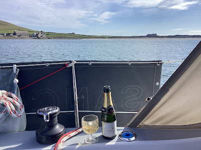
A celebratory drink for finally getting to Shetland after a serious
attempt last year and not being able to "nip over" whilst in
Orkney in 2020 or 2021. 
Grutness anchorage and Sumbough Airport.

61.4 NM in just under 13 hours.
2025 Kirkwall to Gurtness Voe
Slide show Kirkwall to Grutness.

Click here for Gulber Wick, just short of Lerwick.