Showing posts with label Portland inshore route. Show all posts

Tuesday, April 23, 2024

2024 April 20th Day 22, to Hope Cove

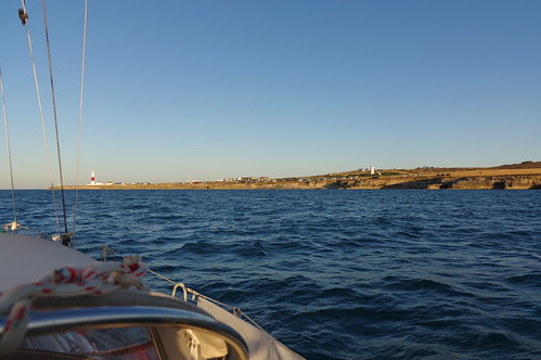
With the "gate" around the Bill of Portland not "opening" until 09:27 there was no need for the normal early start and I weighed anchor at 07:50, and after motoring out of the harbour it was a leisurely sail much of the way down the east side of Portland until the wind shifted and dropped and I was going slowly on a dead run so on went the engine to get to the Bill at the optimum time to get the best push from the west going tide.

As usual there was a flotilla going round, 1 way ahead, 3 of us
pretty much to the schedule and a few well behind.
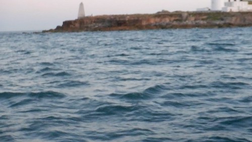
Passing close to the Bill and even closer to the off
lying rocks and pot buoys. Note the scale.
The obelisk on the left marks submerged rocks just offshore. 
I miss judged it very slightly and went round 5 minutes early in benign conditions with the wind filling in from the ENE at 11 knots, up went the cruising chute and I headed off making better than 4 knots, over the next 3 hours I made good progress until the wind died to 6 knots or less so on went the engine.

The first filmed dolphin of the trip, apparently a singleton 
(Common Dolphin).

Unfortunately the engine had to stay on for the rest of the day but on the bright side it did allow me to get all the way to Hope Cove in daylight.

Turning into Hope Cove.
68 nautical miles in twelve and a half hours.

2024 Portland to Hope Cove

Sunday, August 13, 2023

2023 10th August Day 4 To Cawsand Bay, Plymouth

The gate through the Portland inshore route opened at 05:34 but some daylight is needed for the approach as there is usually a lot of pot buoys to avoid, civil twilight started at  05:12 so 06:00 at the Bill was more realistic. As is often the case I was awake before the alarm so had some coffee whilst waiting for the planed start of 04:30, in the event it being a dark night I waited a bit longer for the light to improve enough to see unlit boats and markers, with a nice clean hull I caught up the time, even against a 12 knot wind and a light chop.

Turning to go round at 05:58

DSCF1768

A rather rocky video, it was a little bumpy and I was paying more attention to where I was going than taking the video. Rocks, almost awash at HW neaps extend out from the obelisk on the left.  

Leaving the Bill at 06:01
With the benign conditions I had the sails up within a few minutes of rounding, the next decision was which way to head, the wind was easterly as apposed to the forecast of south or south-east making the normal route close to a dead run. The forecast also said that the wind would veer to the South or South West, the shipping forecast did not give a time for that but the 20:00 download the previous night showed that happening shortly after lunch, to head directly to Start Point could leave me down wind and down tide of it. I therefore headed further south and eventually ended up 5 miles south of the "normal" route.

I started off on a broad reach under all plain sail; most of the time I could have used the cruising chute but the wind was 11 - 12 knots and on a reach 14 knots is the limit and it had been gusting that earlier. Finally I gave in and put the chute up at 9 o'clock and made very quick progress for a couple of hours when I sensed the wind increasing and I got it down just before 16 knots of wind arrived. It didn't last long and stayed a steady easterly at 11 knots until 12:00 when it dropped a little and started veering to southerly by 12:30 and 200 degrees by 16:00. I started to alter course for Start Point at 12:00 and was hard on the wind by 13:00.

My actual track (red) and predicted track at 4 knots with a course to Steer
of 246 degrees allowing for tide (dotted line) and rhumb line (Blue)
It was tight but I made it to my waypoint off  "The Start" without tacking; boats that had tried to go direct were now in trouble way to leeward and with a very adverse tide to get to and past Start Point, a 45 foot boat that was behind me at "The Bill" was now even further behind, VERY satisfying 😀

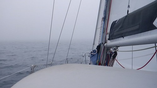
After a very pleasant sail, much with a warm sun, there was still a challenge to be faced, fog. From about 6 mile short of Start Point the visibility quickly reduced.

Fog off The Start
The above was taken just after entering the fog, by the time I was south of Start Point visibility was down to 50 - 100 yards and, with a number of boats about without Automatic Identification System (AIS) things were a little tense, even with Radar - I may have a rant later about boats without radar reflectors!

A close encounter with a fishing boat, never seen. As I approached
Salcombe VHF became busy as people checked in with boats in the
vicinity, some of which were not on AIS. At least one boat without an
AIS receiver was using Marinetraffic.com to track those with a
transceiver but would probably have lost that at some point as I have
always lost mobile signals at some point along this coast (O2, Vodafone
and Smarty).
I did not see any land until the fog started to lift when past Bolt Head, unfortunately it then started to rain and it was a miserable trip on to Cawsands Bay and a difficult approach on a dark night with some remaining fog and light rain. With several old gaffers in the anchorage I went well to the north where there was lots of space but moved south next day for better shelter.

Having got below just after 22:00 for very delayed sundowners, I was not happy when HMS Protector, anchored a few hundred yards away started sounding her very loud fog horn, why that was not sounding in worse visibility when I was struggling to see her as I came in I don't know. Fortunately the noise stopped at about midnight and I could get some much needed sleep.

2023 2 To Plymouth

83 nautical miles over the ground in a little under 18 hours.

Wednesday, April 19, 2023

2023 April 16th Day 2 - Portland to Churston Cove

A day after a neap tide the tidal gate around the Bill opened at 08:14 so daylight was not going to be a problem, on the other hand a late start would probably mean a late arrival. I weighed anchor at 06:15 and in calm conditions and with a reasonably clean hull I arrived half an hour early but in benign conditions and so close to the neap tide I went round early with no problems.

Last year I commented that there always seems to be fishermen
at the harbour entrance, this time it was a couple of guys fishing
from kayaks
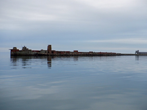
The North Breakwater.
I always have to avoid pot buoys going round the Bill, this
time I had to avoid the Lobster boat as well.

The wind which had been close to zero when I left had increased to SSW at 6 knots so once well clear the sails went up for a chilly but pleasant trip across Lyme Bay kept busy trimming the sails to cope with the variable wind. Without a significant wind shift I clearly wasn’t going to make Hallsands or Plymouth so I was resigned to Torbay, hopefully to anchor rather than spending an expensive night in a marina.

The wind picked up to c 11 knots from the south at mid day then to 15 -17 knots at about 14:00 so it was a quick reach in to Brixham and I was at anchor off of a cove next to the harbour which is in two parts named Fishcombe Cove and Churston Cove, there are now 3 large mooring buoys in the cove effectively filling it so I anchored in 10 metres just off. 

Wending my way to Brixham.

Brixham from the anchorage, Battery Park on the right.
Fishcombe Cove / Churston Cove, Battery Park on the left.
49 nautical miles in 12 hours.


Tuesday, August 16, 2022

2022 Celtic Circuit, Day 3 Portland to Hope Cove

I weighed anchor at 04:30 to get to the Bill as the tidal gate opened, initially I thought there were only two of us taking the inshore route but as I left the Bill there were a lot of boats following behind, either they preferred an hour or two more in bed or they had spent the night in Weymouth and were delayed waiting for the bridge to open.

Portland prison in the early morning light.
Approaching the Bill
To avoid getting swept into the Portland Race, described in the Pilot by Tom Cunliffe as "the most dangerous extended area of broken water in the English Channel, overshadowing even Barfeur, the madness of Ouessant and the Race of Alderney", it is necessary to pass within 300 yards of the Bill, and only then in settled conditions.
My track through the inshore route.
The inshore route can only safely be used in daylight because of lobster pots which are often hard to see as they are dragged under by the strong current and the necessity of passing very close to rocks. Because to fluky winds caused by the land the passage has usually to be done under power, increasing the risk from Pots, as Cunliffe says the possibility of being anchored to a Pot [as the tide increases] does not bare thinking about. On this occasion the wind was from the NE and I was able to sail from a couple of miles north of the Bill when the wind set in, through the route and across Lyme Bay.
A lobster Pot Buoy c 80 yards off the Bill and another much closer in,
these would likely be underwater in an hour or two as the tide increases.
 Note the rock awash in line with the hanging rock, left. The Obelisk
is there to mark them.
Leaving the Bill, the 45 ft boat off my starboard bow overtook
me under power going round the Bill. Equipped only with a
cruising chute she tried tacking down wind, I was soon to get
the symmetrical spinnaker up and was only 1/3 mile behind
her at Start Point, 48 miles further on.
Crossing Lyme Bay with my 60 sq metre
symmetrical spinnaker during a lull in the wind.
I had a fairly quick passage in variable winds that kept me busy sail changing and trimming with some light relief...... 

DSCF1105
Dolphins doing what dolphins do approaching Start Point.

Approaching Start Point, often referred to as THE Start, as it
often was the last bit of English land seen on a voyage in a
sailing ship.
Shortly after the picture was taken the wind disappeared and I started the engine to get to Hope Cove, the first anchorage sheltered from the easterly winds west of West Bay (Portland) and in the days of sail often packed with ships, up to 80 being quoted in one source, waiting for a fair wind up channel.
Entering the Hope Cove anchorage. Lots more pics in the
slide show below.

68 miles over the ground in 13.5 hours.

2022 Summer Portland to Hope Cove

Thursday, March 31, 2022

2022 St Kilda Day 4 & 5 to St Mawes.

The Portland inshore route, normally I would
be a little closer in heading towards the Bill but
I was sailing off a Lee shore so stayed a bit further
out which on a neap tide still gave me a smooth
ride over the Ledge which can be a bit rough.

Day 4

I left Portland at 05:45, half an hour late as the alarm did not go off, perhaps fooled by the change to BST, I motored past the eastern entrance as there was a merchant ship heading for it and I wanted to be well clear, I was then able to sail in 12 - 20 knots of wind and rather more for about an hour, all the way to Plymouth, although there was rather less as I rounded the Bill. 

Sailing down the Bill somewhat reduces the risk from lobster pots but you need the wind to be from the NE through to SE to make this practical as winds from the west are disturbed or blocked by Portland.

It was close to a dead run from the Bill with the wind about 10 degrees on the starboard quarter and then from about 11:00 with it from 10 - 20 degrees off to port. The sea was unfortunately well off the port quarter so the boat was rolling a lot with the occasional broach, especially in the middle of Lyme Bay when the sea was moderately high for several hours as the tide turned to be against the wind.

Making 5 and often more than 6 knots it was a quick passage, I could have gone a bit quicker but frequently reefed the headsail to better control the boat in the steep, breaking sea.

The timing was quite good as the foul flooding tide eased as I passed Start Point which saved me some of the grief you often get from rough seas off of Salcombe and I had a fair tide past bolt tail to Plymouth.

Entering Plymouth harbour was rather entertaining, naturally the wind freshened and I was reaching quickly whilst trying to sort out the lights complicated by a large RFA and HMS Somerset at anchor changing the pattern of background lights and a warship departing without AIS getting between me and a couple of key marks.

I anchored in Jennycliff Bay just after 22:00  in 20 knots of wind which disappeared a few minutes later and I had a quite night.

72 NM over the ground in 17 hours.

Day 5

I left at 07:40 with a favourable tide but the brisk northerly died as I was weighing anchor and was light and variable until I got just past Rame Head under engine, then it was again a run under headsail only all the way to St Mawes.

After the quite night the sea was smooth as I left and with winds generally at the upper end of Force 4 or a light Force 5 the sea never got to the heights I had the previous day but it was still tiring. Video of the SeaFeather working on a broad reach with a quartering sea, best viewed full screen

Entering the St Mawes anchorage and only 1 boat at anchor,
one on a visitors buoy and a few local boats up the river, come
Easter it will start to get busy with visitors and from 1st May
when many of the local boats launch it will likely be heaving.

A fairly quick trip, 39 mile in less than 9 hours at an average speed of 4.7 knots over the ground.

Click here for the trip round the Lizard to Newlyn.

Monday, August 23, 2021

2021 Late Summer Cruise, Days 4 & 5. Portland - Cawsand

Winds were still lighter than the forecast F3 -5 so a long trip across Lyme Bay was in prospect but if the forecast was correct on wind direction I might clear Start Point.

Achilles 9 metres "Sancerre" in the Portland Bill inshore route
The obligatory photo going through the Portland inshore route,
on this occasion about 5 minutes early.

Winds were rather lighter than forecast but I had decent sailing until early evening when I was off Dartmouth and the wind started to veer and drop further. There was some light relief as dusk fell when a large pod of dolphins briefly followed the boat, one youngster breached a yard from the boat getting me wet from the splashdown.

Finally the wind disappeared and rain came reducing visibility so I diverted to Pilchard Cove at the north end of Slapton Sands rather than mess about trying to avoid lobster pots off Start Point under power with rubbish vis. The rain stopped and the arrival at 23:30 was drama free.

56 miles in 16 hours.

I left earlier than planned because the wind had moved round to the north east putting me very close to a lea shore and with the boat lying broadside to the waves she was rolling badly. I motored out past the Skerries Bank then sailed south against the tide, the light wind dropped so I put the motor on as I approached Start Point and unfortunately had to keep it on as the promised F3-5 did not materialised and the choppy sea, presumably coming from winds well to the south meant that progress was very slow or non existent except for the tide so I motored all the way to Cawsand Bay.

The following was taken off of Start Point, there were lots more than shown here, it may be the "super pod" of 80 reported in the area that scared off a shark. I was amongst them for about 20 minutes. Play enlarge as much as you can.

Look for the young animal from 30 secs till the end, I wonder if this is the one that splashed me the previous day? 
Jolie Brise, one of 3 old gaffers in the anchorage, anchoring behind me.
She a very famous boat that won the first Fastnet race, and more later.
She is based on the Hamble and was there on Tuesday before I left.
33 miles in 7.5 hours.

Thursday, July 22, 2021

2021 Summer Cruise, Day 2.

Yet another of my cunning plans that did not work out! All started well with another early start this time at 04:10 to catch the tidal gate for the inshore route round the Bill, according to Reed's Almanac this is 3 hours long but its normal to try and get there as early as practical within that to get the calmest conditions and the longest west going stream across Lyme Bay. But you need to do it under power and in daylight to avoid the numerous lobster pots, so on this occasion I and crews of half a dozen other boats got a little more time in bed and aimed for an hour into the gate.

Achilles 9 metre "Sancerre" at Portland
Portland in the pre-dawn with not a breath of wind.
It was much darker than it looks in the photo.
Achilles 9 metres "Sancerre" heading for the inshore route around Portland Bill
Heading for the inshore route around the Bill.
Achilles 9 metres "Sancerre" leaving the inshore route around Portland Bill
Dawn over the Bill.
Achilles 9 metre "Sancerre" leaving the Portland inshore route
Boats spreading out to cross Lyme bay to various destinations.
Having got round the Bill the question was which way to go, directly across Lyme Bay or along the coast? It was apparent that going direct would mean a lot of motoring and a very long day possibly requiring a rest day afterwards. Going along the coast might give a bit more wind and, spread over two days, more opportunity to wait for the wind, also some scenery. I opted for the scenic route but as things turned out there was very little wind and a lot of of motoring.
Achilles 9 metre "Sancerre" off Charmouth
Golden Cap, east of Lyme Regis and Charmouth is not as
golden as it used to be within my memory with lots of greenery. 
Achilles 9 metre "Sancerre" at Lyme Regis
Lyme Regis was already busy when I arrived at 09:40. It was
also noisy, some from the beach but mainly from power boats
charging around creating wash, It was also hot. I stuck it for
over an hour  when a very light breezes came in so I moved out.
Nice clear water at Lyme, the anchor in more than 3 metres of
water, with the heat wave visibility reduced substantially over
the next couple of days as algae and plankton bloomed.
The light breeze did not last long, I made less than 2 miles in over
3 hours, much of it in the wrong direction so on went the engine
and I reached Beer at 15:40. 
Achilles 9 metre "Sancerre" at Beer
Beer anchorage, not the most comfortable one around - the
current tends to keep the boat pointing roughly parallel to
the coast and waves curl round the head causing the boat to
roll, fortunately the sea was very calm and I had a reasonably
comfortable night.
Achilles 9 metre "Sancerre" at Beer
Looking towards Beer Head from the anchorage.

Portland - Lyme Regis, 20 miles in 5.5 hours.

Lyme Regis to Beer, 9 miles over the ground (6.5 if motoring in straight lines) in 4.8 hours.

Slide show of all my pictures from Portland to Beer, page through by clicking the arrows or click in the centre of the pic to view from Flickr in a new window or full screen:

2021 July Portland - Beer