Saturday, August 29, 2020

Leaving Blyth Sunday or early Monday?

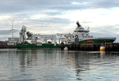
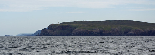
Yesterday (Friday) was rather wild with a northerly wind whipping up the water in the marina, fortunately I am on an inner berth, three yachts that arrived for shelter Thursday and Friday were not as lucky and are being bashed against the pontoon in gale force winds. The Dutch boat was fortunate to get in c 09:00 in 25 knots of wind a few hours before it got a lot worse.


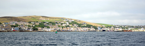
With plenty of room between the pontoon ‘fingers’ I was able to rig the
mooring lines to hold Sancerre well off of the finger for a comfortable albeit
very noisy evening.


Saturday dawned with light winds but that quickly changed and it is again windy and will get worse with gusts of 40 knots predicted. The good news however is that the forecast of some strong winds for Thursday or Friday has been toned down so that I have some flexibility on when to leave which is good as there is some uncertainty as to when I can.

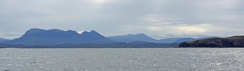
The wind should ease early Sunday morning but with waves predicted to be over 4 metres high close to my route this evening I doubt that it would be comfortable, or safe  to leave early tomorrow, especially with the remaining wind against tide during the morning, also it is likely that anchorages on route would be uncomfortable or untenable until Monday. On the other hand an earlier start would give favourable winds for longer before they turn light and then adverse.

I will be checking again this evening and again in the morning but there appear to be two options, leave about lunchtime tomorrow and sail through the night, probably to the Humber and anchor behind Spurn point or, more likely, to leave very early on Monday morning and go to Lowestoft in 2 or 3 legs stopping off at Spurn and / or Filey (or one of the anchorages a bit further north).

Hopefully I will be able to get home without too many interruptions from the weather, even though I may have to motor quite a bit (I have fuel to get to Lowestoft where I can get more, none is available here). I certainly don’t want another almost 2 week hiatus.


Sunday, August 23, 2020

Stuck in Blyth

Well, it looks like I could be here for a while.


The next safe, all weather and all tide port for a boat that can't take the ground is Lowestoft, ports in between either have locks (most of them), bridges (Whitby) or drying approaches or harbours, single handed it will take 3-4 days to get there, even under engine. 

The last weather window and the one we are in now were not quite long enough and according to the two main models neither are the next two. With winds gusting 45-50 knots forecast for Tuesday / Wednesday and again for Friday so it looks like a boring week with not much to do.


Update Tuesday:

The GFS model says I can leave Thursday ( just) but the ECMWF model says Tuesday next week ☹️ I suspect the GFS is a bit optimistic and it only needs to be a bit off to make it not viable, mainly due to lack of suitable anchorages in  a brisk north wind / high sea, Filey is ok in reasonable conditions but probably not with a big sea running as there it likely to be from today’s nastiness, I’m  not sure about Spurn but that’s 2 days away.

And low tide early evening means I would not be able get into harbours on route.

Still no showers or facilities but compared to a couple who took shelter here yesterday I am living in luxury, they are in a serious hi-tech rowing boat heading to the river Crouch, not sure if they have a tent or if they have to stay on their bunk(s), either way not much room to move. Better them than me.

Slide show all of my pictures from Blyth. Page through by clicking the arrows or click in the centre of the pic to view from Flickr in a new window or full screen:

2020 Blyth

Thursday, August 20, 2020

Stage 24, Lindisfarne to Blyth.

Monday at The Holy Isle was a washout with rain and fog and I stayed on board but there was some excitement in the late afternoon when, after 22 hours on the anchor it started to drag in the strong current through the anchorage. I noticed before the anchor alarms went off but quick work was needed to avoid dragging into the moorings and preferably without using the engine until the anchor was up along with the trip line which could easily get into the propeller where it would hopefully get chopped up by the rope cutter rather than wrapping round the prop, stalling the engine and leaving me without propulsion.

When the anchor came up, I was surprised to find a large car tyre on it with the point of the anchor right through the tyre wall. Fortunately, I was able to get it off fairly quickly and reset the anchor for a peaceful night.

Tuesday dawned with fog banks coming through and with the forecast models coming into agreement for the next few days predicting strong winds from the south, south east and southwest at various times. Although there would be several good days for sailing but generally with headwinds and more importantly on-shore winds which would make planned anchorages (and Lindisfarne) untenable. Gales would also come through at some time between Thursday and Saturday night.

I therefore decided to move immediately to Blyth, the best shelter available in the area to await better weather. In theory, except very close to spring tides, there is enough water over the “bar” into the anchorage for Sancerre to pass at all states of the tide provided the sea is reasonably calm but to be on the safe side I left at 10:30, an hour after low tide for an extra half metre of water and to be going into the tide minimising the speed over the ground making navigation easier.

 Some of the seals leaving Lindisfarne before me, taking the last of the ebb
to get to sea. There were dozens, probably hundreds of them altogether.

A nice 31ft "Golden Hind" class boat, arrived
after me and we later sailed in company
most of the way to Blyth they tracking me
with passive AIS in the fog whilst I tracked 
them on radar.

Shortly after clearing the island and approaches the fog became significantly thicker and visibility varied from about 100 yards to 300 until I was well past Seahouses. The F3 wind was on the nose so I motored through the Inner Sound seeing Bamburgh Castle and the Farne Islands only on radar, keeping speed down to 4 knots to give more time to analyse what was going on. 

I also saw a lot of small fishing boats on radar (but not on AIS), in a half hour period I tracked 7 different boats classified by the radar track as “dangerous”, changed course twice to avoid collision and saw only one boat at a range of 200 feet as we passed. The visibility improved to a half mile or more as I passed Newton Point and with the wind off the bow but not far enough off to make the course but I hoisted the mainsail and motor sailed at good speed – beating along the coast would have meant an arrival in the dark in a forecast blustery wind with rain.

When I turned the next corner I was able to sail but frustratingly the wind changed after about half an hour and it was back to motor sailing. The rainstorms arrived an hour out from Blyth and the wind started to increase. Given immediate clearance to enter the harbour I was alongside at 17:25, 34 miles in 7 hours.

Ironically the warmest weather I have had since leaving St Ives has been the first couple of days in Blyth, Wednesday the winds were light so I would not have got far sailing, but the weather overnight was very wet and windy. Today (Tuesday) there has been lots of warm sunshine with a strong south easterly wind (F4-6) increasing to F7 or Gale 8 later, Saturday is likely to be much the same but there appears to be a good chance of favourable winds for a few days from Sunday. We shall see.

Stuck in Blyth

Monday, August 17, 2020

Stage 23, Ethie Haven to Lindisfarne.

I left on Sunday at 05:20 with very light winds and unfortunately had to motor until close to the Firth of Forth when I was able to make very good speed (up to 6 knots) motor sailing and then from late morning sailing – much quieter and much more pleasant. 


With an abundance of caution the engine went back on about 5 miles out so as to get to the Lindisfarne entrance an hour or so before low tide to give a bit more water over the bar, close to neaps there is enough water for Sancerre to enter but a big wave coming in could make it marginal, so better safe than sorry.
Achilles 9 metre "Sancerre"  Lindisfarne
Coming into Lindisfarne.

The approach into Lindisfarne is quite tight and requires care and reasonable
weather. Coming down the eastern side of the island there are also
lots and lots of lobster pots,

At the time of writing (Monday) I don’t know what my next move will be, forecasts differ but all show a combination of headwinds, sometime strong and south westerlies which would, according to the pilot make the Lindisfarne anchorage uncomfortable. Also fog, drizzle and rain.

Achilles 9 metre "Sancerre"  Lindisfarne
As the fog closed in, its now a bit worse although I can still just make out this boat.
In recent experience this anchorage is busy with 3 yachts, its the first time
 since St Ives that I have shared an anchorage. 

A dash to Blythe looks to be an option but tidal considerations make an intermediate stop about 10 miles out desirable, but those anchorages are likely to be extremely uncomfortable or dangerous in a strong south easterly. At the moment the question is mute as the visibility is about 40 yards and not likely to significantly improve any time soon.

Slide show all of my pictures from Peterhead to Lindisfarne. Page through by clicking the arrows or click in the centre of the pic to view from Flickr in a new window or full screen:

2020 Lindisfarne

Lindisfarne to Blyth.

Stage 22, Peterhead to Ethie Haven (Montrose).

I left Peterhead at 05:50 on Saturday the 15th, still rather short of sleep due to a cramp and varicose veins playing up overnight (I’m still wearing the compression bandage almost 3 days later but they are back under control). It would have been an excellent sail but for the cold and some equipment failure.

When I switched on the electronics the wind instruments failed to work, this happens occasionally when the radio communication to the mast head fails but on this occasion I could not trick it back on. The masthead battery, meant to last 3 – 4 years was replaced during the winter so either it is a duff one, there is a poor connection, or the solar cell is not working well enough. 

Sailing manually without the instruments is not a big problem until you get tired, sailors have done that for thousands of years, but it does mean that the autopilot can not be guided by the wind direction which is problematical in variable winds and particularly in strong winds as sailing to a compass bearing could result in the boat being taken “flat aback” or being knocked down by a gust. The solution is to use the wind vane steering – usually preferred in stronger winds when it works best and unlike the autopilot uses no electricity. 

Setting that up I found it no longer worked, and I know why. In Stromness I was in the cabin when I heard but iirc did not feel a “bang”, I went on deck and saw a large dinghy with two fishermen in it moving away and they were looking at me. I could not see any damage and as the pontoon stuck out further than the back of the boat so I assumed they had hit that. It would appear I was wrong. I still can’t see any damage, but things don’t look to be in alignment. Hopefully one of the parts has just been twisted in its mounting and by easing the clamps I can re-align, that will need to be down from the dinghy which I will do when the opportunity presents, hopefully when at Lindisfarne.

Fortunately, the wind was a fairly steady force 3 so I could use the autopilot and until Montrose Bay when the wind died, I was able to sail all the way. I anchored in a rather exposed anchorage at the south end of Montrose bay but with light winds and a calm sea I had a good, albeit rather short night as another early start was needed.

Ethie Haven to Lindisfarne

Stage 21, Sinclair’s Bay to Peterhead.

I went early to bed with the alarm set for 04:00 to try and get to Peterhead in daylight and to take the last of a favourable wind but I was woken shortly after as the wind and sea increased and although safe enough the un-forecast force 4 – 5 north westerly wind was rather to good to miss so I weight anchor at 23:50 and headed east past Noss Head. And straight into fog.

I was very glad for GPS, radar and particularly the AIS (Automatic Identification System – showing the position of large ships to me and me to them) as I passed close by the Beatrice Windfarm where there were a lot of floodlights whose glare in the fog obscured the lights on the navigation buoys, the same happened on the new field to the east but daylight was breaking and the fog banks were becoming thinner so it was rather less tense.

My most worrying encounter overnight was with a very large oil tanker going south at 1 knot which I was passing in front of when she started to make a turn towards me, was she turning to avoid me? Unlikely as she could have called me by name or blind on channel 16 if my AIS was not transmitting properly. Eventually things became clear as she completed a 180 degree turn and went north making little speed over the ground and was clearly just doing “circuits” to waste time.

I got to Peterhead just after 17:00 having done the whole trip just under headsail, often reefed. That was 78 miles in 17 hours for an average speed of just over 4.5 knots, I could have gone faster but a difficult sea was uncomfortable at that speed and would have been more so with more sail set. 

It was also a very cold trip and on this leg and most of the next two I was wearing winter gear including fleece lined trousers, two fleeces, gloves and full wet weather gear despite the lack of rain for which I was duly grateful. In August!

Having had little sleep and with a couple of long legs to follow, I stayed at Peterhead for a day and was able to get a few fresh items of stores. Update: as I found in 2021 there is an excellent “Morrisons” within walking distance for the reasonably fit.

Watson (46' 9") class lifeboat built in 1952 alongside in Peterhead.


Slide show all of my pictures from Sinclairs Bay to Peterhead. Page through by clicking the arrows or click in the centre of the pic to view from Flickr in a new window or full screen:

2020 Sinclairs Bay - Peterhead

Peterhead to Ethien Haven (Montrose)

Friday, August 14, 2020

Stages 19 & 20, Stromness – Hunda Sound – Sinclair’s Bay (N of Wick).

On Tuesday morning the wind was still adverse but rather better than forecast with mist largely gone by 11:00 and no rain forecast until late afternoon so I decided to move south to shorten Wednesdays trip and to make it easier to time the run to Cantic head – critical for the smoothest trip out of the Pentland Firth and round Duncansby head and to allow a later start which would hopefully avoid rain forecast for Wednesday morning.

Achilles 9 metre "Sancerre" leaving Stromness
Leaving Stromness


So I moved to Hunda Sound between Burray and Hunda islands, cutting short a site seeing trip along the eastern side of Scarpa Flow short as rain approached but then bypassed me, for the moment.  

Rigs parked north of Hunda.

As I had dinner an inquisitive otter came to look me over but when I moved there was a "splosh" and I watched it swim away under water.

Slide show all of my pictures from Stromness to Hunda Sound. Page through by clicking the arrows or click in the centre of the pic to view from Flickr in a new window or full screen:

2020 Stromness - Hunda Sound

3 hours and 14 miles bringing the total over the ground to 999 miles.

The weather was rather strange that evening and in a little over an hour the wind went from SE 12 knots to no wind and a slight mist to fog with visibility 1 – 200 yards and with the wind returning from the SE at 15-20 knots. Then came the thunderstorms, always a nervous time when you are on a boat with your metal mast the highest thing around for some distance. The portable electronics all went into the oven or grill which makes a good “Faraday Cage” to protect them, fortunately I had already had dinner. 


My plan for the morning almost worked with rain stopping at 7:30 after dropping an inch overnight, But it started again shortly after as I was pulling up the anchor (or rather the windlass was) so I set off with poor visibility in mist and fog banks and rain and neither cleared until I approached Cantic Head.

My route out of the Pentland Firth was described as “Sneaky” and "Champaign Sailing" on the owners forum, perhaps it was, but it is the route recommended in the Pilot, passing Cantic head to take the last of the west bound tide to around Aith Hope then head out into the Firth passing south of Soma and north of Stroma both of which have dangerous races around them. With strong tides getting the timing wrong could result in being swept into the Merry Men or more likely getting set on to Soma, care is still required as tides of 9 knots (at springs) run in the centre of the passage south east past Duncansby head to the south and the Pentland Skerries to the north and 16 knots has been reported close to the Skerries.

I had about the most benign conditions possible, one day before neap (weakest) tides, no wind and small waves, initially from the west then from the east. With spot on timing I passed through at the optimal time, just at and after slack water so that although the current never dropped below 1 knot it did not reach more then 3 or 4. The clouds then cleared and for a few hours it was the warmest it had been since I rounded Land's End. With little wind the seas had quietened enough to anchor at Sinclair’s Bay north of Noss Head and Wick.

Achilles 9 metre "Sancerre"  Sinclair's Bay
Noss Head at the south end of Sinclair's Bay with one of two castles 
within a couple of miles, I assume the seat of the Sinclair clan. The other
was too far off to get a good pic but looked like a baronial castle still
in one piece.

32 miles in six and a half hours mainly motoring or motor sailing but with some sailing towards the end.

Slide show all of my pictures from Stromness to Hunda Sound. Page through by clicking the arrows or click in the centre of the pic to view from Flickr in a new window or full screen:

2020 Hunda Sound - Sinclairs Bay

Sinclair’s Bay to Peterhead

Monday, August 10, 2020

9 days in Stromness?

So on Monday evening I was in the marina 985 miles into my round UK trip with no propeller and several stretches of water where sailing single handed without mechanical propulsion would not be sensible, to say the least, so it had to be fixed. 

Sans propeller

Fortunately, I have a spare propeller but at home and in the garage probably buried under heavy things my wife would not be able to move, so help was called in and my recollection of where I had left it was correct or not far off and it was packaged ready to go by late afternoon. Finding a courier to do a pick up and delivery to Orkney in a sensible timescale took rather longer. Particularly annoying on several sites there was no indication of timescales and on others you only found out it would take a week after filling all the details through to payment. Finally, I settled on DPD who “promised” a two-day delivery and a pick up was booked for Tuesday.

What it should look like opened.

That left a lot of time for speculation on the owners group web site as to why a new prop (fitted last winter) should come off, the only thing that was obvious was that the locking allen screw had not done it’s job, probably because the thread locker had not worked and being towed at 11 knots had probably not helped. 

Update: After Sancerre was lifted and the prop and rope cutter were removed for maintenance it became evident that the rope cutter had chewed on something serious, fortunately the damage was repairable but it may explain how the prop was loosened. When putting the engine into gear on route to Plymouth there was a loud bang which at the time I thought was the rope cutter in action, although others suggested it was the prop not opening correctly, it took several changes in gear from forward to astern to clear what ever it was - probably a rope, net or both. It is possible that this was also tangled around the prop, at least after trying to go astern to clear it. The strain was clearly a lot more than I had originally thought and its possible that this loosened things enough that a fast tow finished the job. 

I had left the old retaining nut onboard and a local marine engineer cut and shaped the “key” necessary to stop the prop rotating on the shaft, and a local boat builder swapped a stainless split pin long enough to fit with some of my shorter rigging split pins.

With a GPS track and my recollection of what happened since the last time the prop was obviously there, which was only a few tens of yards away, it was worth looking for the prop and a diver spent some time looking for it but to no avail, it was buried in a metre of fine silt and nowhere to be seen even in the very clean water.

The package finally turned up on Friday, probably having missed the ferry on Wednesday and I spent 3 hours fitting the key to the prop and removing much of the crud on the propeller. The diver came back on Saturday and had the propeller on in a little over an hour. Whilst he was waiting for me to shorten and file the key to fit the shaft he gave the boat a quick scrub and the whole thing, including the key, postage and a generous tip for the scrub, cost less than a scrub would have done on the Hamble.

Many thanks to all concerned in getting the job done.

It looks like I will be in Orkney until Wednesday, there were strongish F4-5 headwinds yesterday and today it’s 15 knots in the marina  and similar is forecast for tomorrow. Apart from gentlemen not sailing up wind, that against a 6 or 7 knot tide (more in places) going through the Pentland Firth, could create very uncomfortable and dangerous seas. From Wednesday there should be following winds albeit somewhat light and variable for several days for me to get to Lindisfarne probably with 2 or 3 stops on the way.

The marina was very reasonable priced at £100 for a week, run largely by volunteer boat owners as are other marinas on the islands.

Stromness – Hunda Sound – Sinclair’s Bay 

Stage 18, Scabster – Stromness.

I was too tired to restart the next day as the tide required either an early start or a late finish even if I anchored in the southern part of Scarpa Flow. On Monday the 3rd, with the tide an hour later I slipped at 06:47 and went back to where I had left off on Saturday as this was the safest route to clear Dunnet Head and other hazards, the wind was light so I was under engine and making good progress until about 2 miles off Scabster when the sea got up and became surprisingly rough and uncomfortable so I slowed to between 3 and 4 knots (which the plan allowed for) and a little late turned east and even with a light following wind a seriously uncomfortable ride east with the easterly tide increasing to about 2 knots.

As I came to the “Merry Men” the tide increased to over 5 knots and the seas miraculously calmed. The pilot notes that east of the Merry Men the seas would be calm but now, with the east going tide, it calmed as I hit the western side of the charted position. It was then a quick and pleasant passage into Scarpa Flow under sail. I even had a sight of the local Killer Whale pod, of course by the time I had got the camera from below they were too far off to photograph.

It was a pleasant sail past Flotta but the wind then blew up to Force 6 and I was not going to weather a  dangerous rock formation with the intriguing name of the “Barrel of Butter” so I started to motor sail and then motor up to Stromness.

Then the next drama unfolded, manoeuvring to get onto the marina pontoon I put the engine into reverse to do what was in effect a 3 point turn, nothing happened and nothing happened when I put it back into forward. Being blown about by a brisk wind I had the anchor out in record time after missing a small moored boat by inches (It was only small so I could have fended off) and came to a halt in an indicated 2 metres of water, the boat draws 1.7, about a hundred yards from the pontoon. So with a falling tide it was another tow, this time from a local power boat owned by the duty volunteer marina “berth master”.

The gear linkage was OK and a quick look under the boat showed the propeller was missing!

Slide show all of my pictures in Stromness. Page through by clicking the arrows or click in the centre of the pic to view from Flickr in a new window or full screen:

2020 Stromness

To be continued - 

9 days in Stromness?

Stage 17, Loch Eriboll – Scabster.

The start of an eventful day stared at 06:40 with plenty of wind from the west and I was making fast progress although not always quite in the right direction as I adjusted course to make it more comfortable in the almost following and confused sea. At this stage I was aiming to cross the Merry Men of May, a very dangerous “Roost” or breaking tidal race that forms on the west going stream, just after the tide turned east and to go straight into Scarpa Flow.

A small group of whales, probably "minke", rather longer than the boat came alongside briefly but I was unable to get photos, the bubbles of one breathing out did get worryingly close at one point!

As the wind died mid-afternoon, I was using the engine and made my waypoint 6 miles short of the Merry Men within a couple of minutes of optimum. Then at about 17:00, 6 mile north of Scabster the engine stopped. A quick investigation in a choppy sea showed that there was no fuel at the engine but there was >= 20 litres of usable fuel (enough for almost 14 hours use) in the tank. Clearly that was not going to be fixed quickly with the most likely cause being the infamous “Diesel Bug” (a Bacteria that lives in oil, particularly if there is water present, if forms a fibrous jelly that can block up the whole system. Sancerre is an unlikely candidate having a bladder fuel tank and therefore little or no condensation in it and having been regularly dosed with proprietary treatments, but no one is completely immune if contaminated fuel, particularly with white diesel including bio diesel, is loaded).

So, it was up with the sails and I started making slow progress towards Scabster in Thurso Bay. Initially I made some progress but the wind dropped to zero and I was being swept towards the race off of Dunnet Head at about 1.5 knots and would likely end up in the Merry Men roust. Having given the coast guard a “heads up” as I set sail we kept in touch until at 18:40 it became clear that the wind was unlikely to return any time soon (it didn’t) and I issued a “Pan Pan” and was towed into Scabster by the RNLI at about 19:30.

I found the problem almost immediately when I started to clear the cockpit locker to turn off the fuel before checking the primary fuel filter. The base of the locker rests on the hull outboard and a fairly narrow (about 15mm) batten on the inboard side. I had reinforced the top of the floorboards with a strong-back in case the boat inverted in a knock down and to stop reserve fuel cans sliding about, but did not think to do anything under the floor as it had been OK for 40 odd years. 

Not knowing where I could next refuel I had put completely full cans in pace at Port Ellen (usually I only put 15 litres in my two 20 Litre cans to make them easier to handle) and with a top up at Tobermory I had 75 litres weighing over 70 Kg on the floor. Then having had very rolling seas for 20 miles or so the floor shifted and with some damage slipped down and trapped the flexible fuel line stopping fuel flowing. 

Getting the fuel flowing again was then easy although bleeding the engine was not as I found I could not get one of my spanners onto one of the injectors, but in the end (about 21:00) the engine fired up again and I then had an hour or so putting all of the removed woodwork back in place.

Wednesday, August 5, 2020

Stage 16, Loch Nedd to Loch Eriboll.

With strong winds coming through in bands it was another difficult call on the weather and with Cape Wrath being notorious for big seas I was expecting to be stuck in Loch Nedd for a day or two but on Friday morning (the 31st) the weather maps showed a potential chance as a front moved through giving calmer conditions with continuing offshore winds keeping the seas calm.

This was not reflected in the met office forecasts which covered a much larger area so I phoned a forecaster at weatherweb.net to review and that confirmed my suspicions and even better the wind should likely swing to the southwest early in the evening (we estimated 17:00 or a bit later at Cape Wrath) which would help me to move east  towards Lock Eriboll. Further good news was that the tides should work and be favourable all the way so I quickly got ready and left at 10:00.

And things worked out very well, as on the previous day I started off with just the reefed genoa but as the wind dropped I progressively moved to the full genoa and mainsail, approaching Cape Wrath I could have put up the cruising chute but decided not to as squally showers on the approaching front were a distinct possibility.

Achilles 9 metre "Sancerre" Cape Wrath
Cape Wrath from the west. Lots has been written about how impressive the cape 
is. Initially I was not impressed but then I realised I was 2 miles away and then 
I saw the north side - see the next picture.

Three miles short of the Cape the wind ran out and then veered 90 degrees in 20 minutes and perking up to F3, however it kept dying so I used the engine on occasion to reach the entrance of Loch Eriboll a little before 6:30. 

Achilles 9 metre "Sancerre" Cape Wrath
The north side of Cape Wrath.

My planned anchorage was on the western side of the entrance, the pilot mentioned that mooring buoys restricted swinging room but that was an understatement, additional mooring buoys now in place would have made it unusable before a lot of pot buoys(?) were put down so I had to abandon that and moved further into the loch to Port Portnancon, another small anchorage on the west side. When I arrived I found a new looking, unused mooring buoy in “position A”. Other sailors are reporting this sort of thing a lot and there is a growing belief that buoys are being put down to keep visiting yachtsmen away to preserve the privacy of house owners.

I anchored as close as sensible to the mooring buoy in what appeared to be good holding but very close to the shore so set the anchor alarm with very tight parameters. As it happened that proved unnecessary because just after the tide turned I noticed the anchor was dragging and I got the engine running just as the alarm went off. I had anchored in thick Kelp which held against the engine when tested but let go as the boat swung. Fortunately the windlass was powerful enough to haul it all up. Parts of the plants reached back to the middle of the boat and I doubt I could have lifted it by hand. Fortunately there was another anchorage on the eastern shore and I moved there and spend a quite night.

48 miles in eleven and a half hours plus moving the anchorage.

Slide show all of my pictures from Loch Nedd to Loch Eribol. Page through by clicking the arrows or click in the centre of the pic to view from Flickr in a new window or full screen:

2020 Loch Nedd - Loch Eriboll

Stage 15, Loch Ewe to Loch Nedd.

It was a close call on the weather with rough water often occurring at Stoerhead and strong (Force 6) winds forecasted early on moderating to F4 -5. But the winds were from the east or southeast so calm seas with the offshore wind and comfortably off the wind for most of the way so off I set, again with an early, 04:40, start.

Once clear of the Loch I was soon making 5 – 5.5 knots under a double reefed headsail with no mainsail.  The wind was up and down for a while until approaching Stoerhead it was down to a modest F3 with a comfortable sea.

Things changed quite quickly as I rounded the headland with quite a big sea coming from the north, left over from very strong winds a day or two earlier to the north east. On top of that were waves coming out of the lochs from what was now an easterly force 5 making for a very nasty sea. Not being far from my planned destination I switched to the engine and had a very uncomfortable ride as I past Oldany Island.


Achilles 9 metre "Sancerre" Old Man of Stoer
The "Old Man of Stoer" near Stoerhead

I had planned to anchor in Loch Drombaig a small loch behind multiple islands with an entrance about a hundred yards wide, it did not take long to decide that was not a good idea with seas breaking all round so I carried on to Loch Nedd a narrow lock but with a safe entrance and with good shelter.

Achilles 9 metre "Sancerre" Loch Ned
Looking north down Loch Nedd.

33 miles in ten and a half hours.

Slide show all of my pictures from Loch Ewe to Loch Nedd. Page through by clicking the arrows or click in the centre of the pic to view from Flickr in a new window or full screen:

2020 Loch Ewe - Loch Nedd

Loch Nedd to Loch Eriboll

Stage 14, Broadford to Loch Ewe.

My track compared to the original plan, 
I was using the autopilot so my track
(red) is covered by the plan (blue)

The weather remained damp and chilly and with strong winds forecast I decided against my planned stop off in Lochs Torridon and Diabaig and headed straight for Loch Ewe, once a fairly important naval anchorage which still has a NATO refuelling pier for warships. This move would also position me well for possible weather windows to get to Orkney.

Tide was less important for this leg but it was another early start at 05:10 to make quite a long hop with some uncertainty about the wind.

The weather went from nothing to NW F5 and back to westerly F4 in less than an hour and stayed that way until well into Loch Ewe when it dropped away to nothing.

I was largely past the BUTEC testing range before trials started and was disappointed not to see at least the periscope of the submarine reported to be about.

I anchored at Aultbea, further into the Loch than planned at the outer ones looked rather exposed and quite small.

48 miles in 11 hours 20 minutes.

Achilles 9 metre "Sancerre" Loch Ewe
The fortified entrance to Loch Ewe

Achilles 9 metre "Sancerre" Loch Ewe
The south end of Loch Ewe with the NATO fuelling point on the left.

Achilles 9 metre "Sancerre" Loch Ewe
The anchorage at sunset.

Slide show all of my pictures from Broadford Bay to Loch Ewe. Page through by clicking the arrows or click in the centre of the pic to view from Flickr in a new window or full screen:

2020 Broadford - Loch Ewe

Loch Ewe to Loch Nedd.

Tuesday, August 4, 2020

Stage 13, Tobermory - Broadford.

Tobermory to Broadford Bay.
From here on right through to Stromness catching weather windows was key and fortunately they generally matched up with tidal gates albeit requiring some early starts. 

Finding the weather windows was not easy, the met office inshore forecasts available from the internet, the BBC and transmitted on VHF by the coastguard at regular intervals, are generally pretty good and give guidance for the following 24 hours and the 24 hours after that, within the day a change in the second 12 hours is identified as being “later” but generally that is it, which is often not good enough. Also the areas can be quite large and especially in the Scottish Islands local effects can be very significant. 

So I back up the met office information with multiple 3 hourly weather maps, one from the European Centre for Medium Range Forecasting (the ECMWF model), the American government’s General Forecasting System (the GFS) and two from the Australian commercial operation “Predictwind”. These can be downloaded in high resolution over the internet and at 50km or 100 km resolution via satellite, useful when you can’t get a cell phone signal.

Tobermory to Broadford bay presented a particular challenge as the route north of the Isle of Skye requires a passage through the Kyle Rhea a narrow channel where tides run at 8 knots, faster than the boat will go – so it has to be going in the right direction.

A narrow weather window became evident on the 27th although with very light winds it would require motoring most of the way to make the tidal gate but it would position me better for another window in 2 or 3 days. So I left at five in the morning, out of the sound of Mull past the Point of Ardnamurchan, often an uncomfortable area and up past Muck, Eigg and through the Sound of Sleat.

Achilles 9 metre "Sancerre" Ardnamurchan Point
Point of Ardnamurchan in benign weather.

Achilles 9 metre "Sancerre" Sound of Sleat
The mainland as I entered the Sound of Sleat - the best weather on this leg of the trip.

I made the tidal gate at Kyle by less than 45 minutes, getting through at slack water and about 1.5 knots of adverse tide for the last threequarters of a mile. 

The planned route through Kyle Rhea then west under the Skye road bridge.

The best part of this leg was watching Sea Otters fishing, they almost always came up with something to eat, one was 1.7 miles from the nearest shore and several families were taking the benefit of slack water in Kyle Rhea, with an 8 knot tide it would be a long hard swim or walk home if they got the timing wrong.

Achilles 9 metre "Sancerre" Sky Bridge
Skye bridge from the east,

The whole passage so far had been in dull overcast and chilly weather but now rain showers started. Although I had planned to go as far as Broadford Bay, just in case, I had intended to anchor in a small bay just short of the Skye bridge but on arrival found it littered with mooring buoys so I had to fight my way under the bridge against the tide and increasing wind before heading westward to anchor in Broadford Bay which on the first night was quite comfortable but with the wind coming more from the NW became less so as I waited for force 7 winds to pass by. 

Achilles 9 metre "Sancerre" Sky Bridge
Passing under the bridge was a little disconcerting,
the top of the mast looking very close when in fact the
"Air draft" is 35 metres and the mast is only about
12 metres high.

Achilles 9 metre "Sancerre" Broadford Bay
Broadford Bay.

58 miles in ten and a half hours.

Slide show all of my pictures from Tobermory to Broadford Bay. Page through by clicking the arrows or click in the centre of the pic to view from Flickr in a new window or full screen:

2020 Tobermory - Broadford Bay

Broadford to Loch Ewe