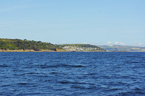
Showing posts with label St Michaels Mount. Show all posts

Sunday, April 3, 2022

2022 St Kilda Days 6 - 16 Stuck in Newlyn.

It is now Sunday, day 11 and I have been here 5 days and it looks like I will be here for a long time, I need a couple of days of clear weather and not much sea off of Lands End, at the moment there is no window apparent for at least a week. 

Todays the wind is light but its forecast to come in from the North West - dead on the nose going to the Irish coast and almost so going to Milford Haven. Increasing to Force 6 at times tomorrow and it is a very cold wind. Depending on which model you look at there could be gusts over 40 knots on Wednesday or Thursday and another band of high winds arriving next weekend.

The European Centre for Medium range Weather Forecasting
(ECMWF) forecast gust map for early Thursday.
And the ECMWF for next Sunday. 39 knots off Lands End
but 57 Knots off the coast of Ireland and that could easily
be further east.
The weather systems are complicated and the forecasts are constantly changing, even a day or two out so I can only hope they change for the better.

In the meantime, the list of odd jobs needed on the boat is already unusually short and soon there will be nothing left that I can do here, almost an unheard of situation on a boat.

Update Tuesday:


The UK Met Office inshore forecast…. here it comes.

Lyme Regis to Lands End including the Isles of Scilly - Strong wind warning

24 hour forecast: West 4 to 6 backing southwest 6 or 7. Slight or moderate, becoming moderate or rough, then very rough later in far west. Rain then showers. Good, occasionally moderate.

Outlook for the following 24 hours: Southwest 6 or 7, occasionally gale 8 at first, veering northwest 4 or 5, increasing 6 or 7 for a time. Moderate or rough, but very rough at first in west and slight later in lyme bay. Rain or showers. Good, occasionally poor. 
  

Lands End to St Davids Head including the Bristol Channel - Strong wind warning

24 hour forecast: Southwesterly 4 to 6, increasing 6 or 7, perhaps gale 8 later in west. Slight at first in east, otherwise moderate becoming moderate or rough, then very rough in west. Rain then showers. Good, occasionally moderate.

Outlook for the following 24 hours: Southwesterly 6 to gale 8, veering westerly or northwesterly 4 to 6, increasing 7 or gale 8 for a time. Moderate or rough, but very rough at first in west and slight later in east. Showers. Good, occasionally moderate.

A rough sea is not normally something I will set out into, especially near Lands End. Very rough does not bare thinking of in those waters.

There may be a window Friday/ Saturday to get to Milford but the models do not agree.

Update Friday 8th April


Finally I will be moving out, initially to anchor and save a days mooring fee that are now the rather expensive summer rates. Then tomorrow I will head off to Milford Haven, ideally I would go on the morning tide at 02:30 but the wind is likely to be a cold northerly and it would be wind against tide going round Lands End. So, unless the forecasts change, I'll leave at lunch time when winds will either be lighter and / or hopefully favourable and the sea will have had some time to calm down. The downside will be a long night at sea.

I had been having occasional problems with the starter motor solenoid needing several pushes of the starter button to get the starter engaged so whilst weather bound, I took the opportunity to replace the engines starter motor as described here.

2022 St Kilda Day 16 St Michael's Mount

Click here for the trip to Milford Haven.

Wednesday, September 1, 2021

2021 Late Summer Cruise, Days 13 - 17, St Helen's Pool - Newlyn.

I ended deciding on the long and winding road out rather than the route through St Helen's Gap (see previous post), the main reason for this was that the sea was very calm so that some rocks on the right hand side of the channel that were just under water were not visible (even very small waves would have showed them) so I would have been relying on the GPS and eyeballing the more distant rocks to find the channel. A very calm sea also gives more clearance over submerged rocks on the route through the islands.

My track (rounded somewhat) coming out, in theory I could
have gone almost direct to "Hats" but at 06:30 there would not
be much water so I kept to the deeper water and had at least
 1.5 -2 metres under the keel all the way through. The slight
movement north of track before heading east was when I was
hoisting sail.
Achilles 9 metres "Sancerre" leaving the Isles of Scilly
The large screen iPad close to eye level showing Admiralty
charts and the GPS position was easier to use than the smaller
plotter which I was using as back up and to display the
planned track. There I was in 3.8 metres of water so about 2m
under the keel and I was going at what in practical terms is my minimum
speed of 2.4 knots through the water when against the light wind.
Achilles 9 metres "Sancerre" leaving the Isles of Scilly
Looking back to St Helens on the left and Tean on the right,
just visible left of centre is the lighthouse on Round Island. 
Achilles 9 metres "Sancerre" leaving the Isles of Scilly
Old Grimsby.
Achilles 9 metres "Sancerre" leaving the Isles of Scilly
St Helens Left, round Island and Old Man.
Slide show of all my pictures from St Marys to St Helens Pool, page through by clicking the arrows or click in the centre of the pic to view from Flickr in a new window or full screen:

2021 St Helens Pool - Newlyn

Leaving Crow sound I had a decent wind from the ENE although progress was slow with rather broken seas caused by the strong tide against the wind. Clearing the tide race I speeded up and was making reasonable progress hard on the wind until I switched on the engine to cross the Traffic Separation scheme (this one has to be crossed with the boat pointed east and I could not make that under sail). Unfortunately the wind died as I crossed so the engine stayed on until I was almost south of Longships, thereafter the wind went right round the clock ending back at Northerly as I came into Mounts Bay. With wind forecast to be E or NE for several days and Newlyn was likely to be full so I went back to St Michael's Mount for the night.
The N bound TSS lane was quite busy and I had to take action
to avoid two joining from the east.
Achilles 9 metres "Sancerre" off the Runnel Stone
South of the Runnel Stone under the cruising chute, but slow
progress in light winds.
Slide show of the RNLI lifeguard at Marazion, aided by some paddle boarders rescuing a family being blown out to sea in an inflatable. Page through by clicking the arrows or click in the centre of the pic to view from Flickr in a new window or full screen:

2021 Marazion RNLI
Marizion RNLI
Next morning one of my cunning plans actually worked, there is limited capacity at Newlyn and access to Penzance is limited to close to HW, with tides as they were anyone leaving Newlyn east or west would leave as early as possible, so I arrived outside at 07:00 and there was a choice of berths. It was just as well I did that because by early evening boats were double parked with 3 boats in most bays which is a bit of a squeeze. I had an 11 metre boat rafted up on me (Sancerre is 9 metres) and the smallish boat on the other side of the pontoon finger had an even bigger one. 

Now (Wednesday) on my second day here and having done my visiting in Hayle I may be able to move out tomorrow back to St Michael's Mount for the night to save a days berthing charges, then go round the Lizard to St Mawes on Friday and onto Fowey on Saturday before becoming weather bound again, this time with winds from the south or south west. 

The Cheese shop [update: now moved to Penzance] and Chinese takeaway in Newlyn are both to be recommended, Camping Gaz at the Chandlery however was rather expensive.

38 miles over the ground to St Michael's Mount in 9.5 hours.

Thursday, August 26, 2021

2021 Late Summer Cruise, Days 8 & 9. St Mawes - St Michaels Mount - Hugh Town, St Mary's.

The trip around the lizard was in blustery conditions with the wind varying between F4 and F6 but mainly F5, with the tide against the wind I was sure to give Lizard Point a wide berth. With the wind in the NE there was a reasonable chance of going direct to The Isles of Scilly arriving in day light but that was not to be as the wind backed to the east making it a slower (and uncomfortable) dead run and the forecast suggested the wind would drop substantially. As I did not want to arrive in the dark I headed into Mounts Bay to spend the night. 

Newlyn it not good in an easterly and anchoring off potentially very uncomfortable, even untenable. That leaves anchoring off Mousehole behind the island or, my preference behind St Michael's Mount, the pilot was however somewhat equivocal saying the latter was only suitable in settled conditions, so I rang up a sailing contact who sails from the Fal and Helford, he in turn contacted a friend who has sailed the waters for 60 years and in his early years fished them professionally, his recommendation was emphatically for St Michael's Mount so there I went to spend a peaceful night.

Achilles 9 metre "Sancerre" at St Michael's Mount
Approaching St Michael's Mount
Achilles 9 metre "Sancerre" at St Michael's Mount
From the anchorage.
Achilles 9 metre "Sancerre" at St Michael's Mount
Marazion from the anchorage.

36 miles over the ground in 7 hours.

The wind was initially moderate on Wednesday and I set off at 08:00 with adverse tide for some hours but making good speed. The wind increases to F5 which with wind against tide generated some serious waves south of Lands End and being on a dead run the boat was rolling heavily at times especially when hit by breaking waves. I sailed with the full genoa boomed out to starboard and the mainsail with one reef to port stabilised by a preventer to the bow, although the full main is only half the size of the genoa the reef reduced the roll and the tendency for the boat to round up when hit by a wave.

Gannets find a shoal of fish.  
The ferry "Scillonian" on route to St Mary's, she has a reputation
of giving many passengers mal-de-mare, this picture gives
some idea why, she is closer than the admittedly large yacht, at
  68 metres she is definitely on the small side for a passenger ship
and the sea on the route can be very rough.
A few miles from St Marys the wind started to veer and I had to gybe, a lengthy process with a boomed out headsail and a preventer rigged, it proved a waste of time as the wind started to drop and the boat became less stable so I put on the engine for the last 4 miles through some very rough seas.
Achilles 9 metre "Sancerre" St Marys Scilly Islands
Almost there and clearing the strong tide so calmer water, Peninnis Head,
the southern tip of St Mary's guarding the passage south of the Island.
Achilles 9 metres "Sancerre" off Port Cressa, Isles of Scilly
The seas quickly moderated in the channel, here entering the inshore
passage a couple of hundred yards wide just past Port Cressa
Achilles 9 metre "Sancerre" St Marys Scilly Islands
And to Port.
I was lucky with the timing as the Scillonian had already left
the harbour and I was clear of the channel before she got there.
Achilles 9 metre "Sancerre" St Marys Scilly Islands
Hugh Town, St Mary's
Achilles 9 metre "Sancerre" St Marys Scilly Islands
Boats are packed in here.
Achilles 9 metre "Sancerre" St Marys Scilly Islands
Try and spot Sancerre.

41 miles over the ground in 9 hours.

Slide show of my pictures from St Mawes to St Marys, page through by clicking the arrows or click in the centre of the pic to view from Flickr in a new window or full screen: 

Aug 2021 St Mawes - St Marys