Sunday, July 19, 2020

Stages 7 & 8, Dublin – Dundalk Bay – Ardglass.

Another generally dull overcast day with a few light showers but with a decent wind. I left at six o’clock to get the benefit of some northerly flowing tide across Dublin Bay, progress was good and I was reaching at a decent speed for most of the day. 

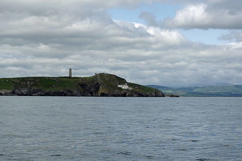
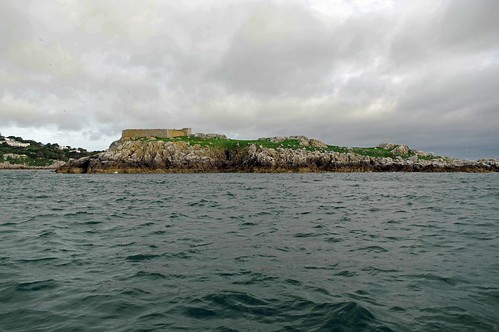
Achilles 9 metre "Sancerre" of Dalkney Island, Dublin
Dalkney Island just east of Sorrento point guarding the southern
approach to Dublin bay with its castle and Martello tower.


Achilles 9 metre "Sancerre" of Muglins, Dublin
Muglins, Dublin Bay

Achilles 9 metre "Sancerre" of Lamby Island, Dublin
Lamby Island, north of Dublin.

The wind piped up to 15 knots plus as I approached Dundalk Bay and I started to get a bad feeling about my chosen anchorage on the south side which would give most shelter from the south westerly wind. 

I’m not quite certain why I decided not to anchor there, in theory it looked good with a sandy bottom and good shelter but it is very shallow, as is much of the bay, and the echo sounder was not quite agreeing with the charted depths (the chart is marked "Owing to the age and quality of the source information, some detail on this [area] may not be positioned accurately") so having manoeuvred round a couple of charted shallow areas (c 1m) I started to get cold feet. Also the wind was forecast to veer to the west or north west (again) which could put me on a lea shore sometime during the night. 

Update: I would have been a bit more comfortable if I then had the Admiralty Leisure Folio for the area (SC5621), sheet 3 has Dundalk Bay with much more detail than the Imray chart or the plotter, although shifting banks would still be an issue.

The question was, what to do instead? Ardglass was 5 hours away and has a narrow entrance to the marina so I discounted that, which left the choice of the exposed northern part of Dundalk Bay or going into Carlingford. 

I set a course for somewhere in between and consulted the Pilot and chart, I could easily get into Carlingford and there are a few places to anchor but I could have difficulty getting out against the tide early next morning so I went to have a look at the north western side of Dundalk bay, tracking along the shore as far west as it seemed sensible to go in the very extensive shoal water. 

I was right on low water so calculation was easy and I knew depths would only improve with time and if I did hit an uncharted mound I would float off, just in case I went slowly under engine and turned when I reached four metres, giving me a couple of metres and a bit in hand. 

Dundalk Bay is about 7.5 nautical miles wide (roughly north to south)
and about the same east to west at high tide.

The wind was now blowing 20 knots but as I moved south and the fetch reduced, things got a little calmer and I eventually dropped the hook just short of the narrow drying channel into Dundalk in 3.6m. With 30 metres of chain out the boat was certainly quite lively, occasionally pitching quite badly but not rolling. I left the chart plotters anchor alarm on for a while but having got a good transit turned that off after an hour or so. 

I turned in with the wind still quite strong and gusting past 20 knots but knowing that the anchor was holding, I had a mile of water behind me and if something went wrong when the wind veered I would then have miles of sea room to leaward.

I woke in the morning to a F3 westerly and relative calm, wanting to get to Ardglass before the shops shut I was away by 6:30, although that was not without incident – the anchor (a 10Kg Delta) had, under the rigors of holding the boat the previous evening, buried itself so deeply that the windlass would not shift it. 

With the chain vertical I engaged the chain stopper and pulled in a link or three whenever the opportunity occurred and eventually the boats motion freed the anchor before I had to resort to the engine or wait for the tide to rise significantly. Worrying at the time because although I thought I knew what had happened  I might have fouled something but reassuring that the anchor is worth its “high holding power” rating.

Sailing was pleasant until approaching Dundrum bay when the wind dropped so I bit the bullet and motored the last 12 miles or so. Arriving at Ardglass, which I had last seen in 1972 when I was stationed nearby with the RAF, at 12:40. It was then nice to meet up with Liam, a 30 year Achilles 24 owner for a quick chat late in the afternoon.

Sunday was spent revictualing the boat, laundry, filling up with diesel (by porterage) as the next convenient opportunity on the planned route would likely be Tobermory, and getting the blog up-to-date.  The plan is to move on to a suitable bay north of here before crossing the North channel and making for Islay.

One of 2 seals in Ardglass harbour hoping for a free lunch, the 
anglers sometime oblige.

Dublin to Ardglass – 78 miles and 16 hours.  

Slide show all of my pictures from Sorrento Bay to Ardglass. Page through by clicking the arrows or click in the centre of the pic to view from Flickr in a new window or full screen:
2020 Sorrento Bay - Ardglass

Ardglass - Browns Bay - Port Ellen

Stages 5 & 6, Rosslare - Roney Head - Dublin.

After a tough day and a half from St Ives but a good nights sleep I decided against the planned rest day in favour of a relatively short leg on Wednesday, after a lie-in waiting for the tide I left at 11:40 towards Arklow in good weather reaching in 8 – 11 knots of wind. It would have been a late finish to go all the way so I anchored behind Roney Head at 17:30.

At 07:00 next morning I was off again in overcast but generally dry weather anchoring in Sorrento Bay Dublin at 17:15.

71 miles over the two days with just over 16 hours on the move with some interesting navigation inside the offshore banks that run all of the way from Rosslare to Dublin.


Achilles 9 metre "Sancerre" off Wicklow Head
Approaching Wicklow Head.

Achilles 9 metre "Sancerre" off Wicklow Head
Wicklow Head

Achilles 9 metre "Sancerre" in Sorrento Bay
Sorrento Bay Dublin is a popular bathing spot.

Unfortunately there are often idiots about, in this case 
on jet skis and driving power boats very close to the swimmers
and me - costing a glass of wine spilled on the cockpit floor 😒


Slide show all of my pictures from Rosslare to Sorrento Bay. Page through by clicking the arrows or click in the centre of the pic to view from Flickr in a new window or full screen:

2020 Rosslare - Sorrento Bay

Dublin – Dundalk Bay – Ardglass

Saturday, July 18, 2020

Stage 4, To Ireland

I was up bright and early and was away by 05:15 in light winds, a couple of hours later I was past the “Wave Hub” experimental site and sailing with the Cruising Chute in 11 knots of south westerly wind. That did not last for long and by 09:40 the wind was up to 12 knots gusting 16 and one of those gusts causing a broach during which the flogging chute threw off the snap shackle, something that would be repeated a few days later so it looks as if I will have to remake the spinnaker sheets with better snap shackles.

My actual track (red) from St Ives to Ireland. The solid
blue line is the direct rhumb line and the dotted blue line
the planned track allowing for the tide sailing at 4.5 knots
.
The 08:00 download of four different weather maps from PredictWind showed the wind veering to NW or NWByN in the evening but with different timings, other forecasts suggested the wind might become northerly. I took a gamble and beam reached well above the rhumb line (adjusted for tide) making 0.5 – 1.0 knots more speed than I would have done on the wider reach, this would allow me to have a good go at getting to Rosslare rather than Fishguard as planned which should then give an easier route north sailing in calmer waters in offshore winds than sticking to the English side and its lea shores. But if the wind did go northerly I should be in a good position to revert to Fishguard or Milford Haven as the next stop.

I had hoped to go through the Menai Straights on this trip but the tides were not going to be right so that will have to wait for another year. 

By mid-afternoon it was blowing 17 -20 knots, 244 degrees and by 20:00 it was round to 329 degrees and I was well over 20 miles west of the rhumb line. As the wind veered, I came closer to the wind and was close hauled coming into the Irish course but managed to make Cansore Point without tacking and anchored in St Margaret’s bay, two and a half miles south of Rosslare which offers better protection from a NW wind than anchorages closer and with an easier route out to the north.

The downside of this route was the Covid lock down and quarantine requirements in the Republic that meant that the first place I would be able to go ashore would be the northern shore of Carlingford Loch. 

Gannets diving as I closed in on Ireland, the fish were having
a bad time as a very large pod of dolphins were also feeding.
134 NM in just under 31 hours.


Rosslare - Roney Head - Dublin.

Stage 3, St Mawes to St Ives

Well, as often happens plans change. A lovely day on Sunday but little wind early and as things turned out little all day despite a forecast of "variable [force] 3 or less, occasionally [force] 4". I decided I might as well leave early and risk the tides at the Lizard, at least we were close to neaps and in the back of mind was the possibility of a stop for lunch in one of the little bays along the Lizard peninsular.

Achilles 9 metre "Sancerre" off Pendennis
Passing Pendennis Point on the west side of the Fal.

Achilles 9 metre "Sancerre" off St Anthony Head
And St Anthony Head on the east side.
After clearing St Anthony Head what little wind there was disappeared so I motored on, and on. Getting close to the Lizard and past the half dozen ships anchored there “for orders” I got to thinking and did some calculations, they showed that if I motored on across Mounts Bay I would arrive at the Runnel stone, south east of Lands End at about 17:00 almost the perfect time to get around Land’s end and that would enable me to get to St Ives, a good setting off point for the north and it would enable me to get quite a long way north before the forecast south westerly wind went to northwest or even north. So I pressed on.

Achilles 9 metre "Sancerre" off Lands End

Achilles 9 metre "Sancerre" off Lands End

The Long Ships light with Lands end behind
The Long Ships light with Land's End behind.

 By cutting a few corners in the calm conditions I arrived for the rounding a bit earlier than ideal, slack water almost to Cape Cornwall rather than a helping tide, the rounding often quite challenging was straightforward and I final got to sail for a while with the big symmetrical spinnaker. I arrived off St Ives at 20:00, 60 miles on the clock.

Achilles 9 metre "Sancerre" off St Ives
St Ives
Slide show all of my pictures from St Mawes to St Ives. Page through by clicking the arrows or click in the centre of the pic to view from Flickr in a new window or full screen:

Saturday, July 11, 2020

Stage 2 of my July Trip, Plymouth to St Mawes.

As forecast, the weather was miserable with strong headwinds on Wednesday, due anyway to be a rest day, and the same on Thursday so it was Friday morning before I set off west again, there was little wind at 08:00 when I left but by the time I was past Rame Head (just west of Plymouth Sound) there was plenty enough wind to sail and not long after I was reefing as the wind increased. 


The wind was variable in direction for the whole trip between northwest and north initially from 8 - 12 knots and from about half way to St Mawes from 12 - 18 knots with a few gusts above. With his wind I was almost always making over 5 knots and often over 6 with a knot or so of tide helping for the last few hours. The 37 nautical miles over the ground was completed in almost exactly 8 hours, anchor up to anchor down off St Mawes. A quick passage leading at least one poster on Flickr to think I was using the engine.

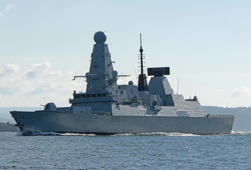
The Type 35 destroyer HMS Defender on exercise just west
of Rame Head.


St Mawes is a favourite haunt although in a normal year it
 can get very crowded and although some of the food is not up to
scratch there is a decent little Co-op and the pub is OK.

The forecast showed little or no wind on Saturday, although it turned out to be quite breezy in the afternoon, so I took another rest day and the opportunity to meet up with a couple of fellow owners of Achilles type yachts with social distancing achieved by rafting the three boats up, me anchored in the middle with Ron tied on to Sancerre to starboard in his Hustler 25 (his Achilles 24 being out of the water) and Rolland in his A24 "Hot Foot" to port, and we largely stayed on our own boats. 

Achilles 9 metre "Sancerre" in St Mawes
Ron and Sue alongside on "Carrie Ann"

A24 Hot Foot

Hot Foot coming alongside under sail, the video 
is by Ron, temporarily on Sancerre for the arrival.

Tomorrow (Sunday) I plan to make for Newlyn, it will be a latish start as the tide off the Lizard is not favourable until after lunch, with the forecast showing light winds it could be quite a late arrival. Then on Monday I will be going round Land's End and heading north.

Slide show all of my pictures from Plymouth to St Mawes. Page through by clicking the arrows or click in the centre of the pic to view from Flickr in a new window or full screen:

2020 Plymouth - St Mawes

Wednesday, July 8, 2020

Stage one of my July trip, Hamble to Plymouth

Like the season, this trip started late, this time delayed from Saturday by the weather with gales and severe gales in the channel, I eventually got away on Monday, but even that was delayed as the best time to leave was at the end of the high tide "stand" on the Hamble at 03:00 to take the last of the ebb down the Solent, but it was still quite windy so I left it until 08:00, the still brisk wind would enable me to make reasonable progress against the adverse 2 – 3 knot tide by keeping to the shallows and not having to tack to arrive at Hurst as the tide turned favourable. This almost went to plan, I almost made it on one tack from Calshot to Hurst but, a little help was needed from the engine for 10 or 15 minutes to clear "Sconce" buoy without tacking.


I passed the Needles at about 13:00 and after avoiding the southern part of the Shambles bank headed for a point well off Portland to avoid the race and almost certain rough seas closer in, especially with the wind against tide.


A big modern Schooner overtaking me approaching the Needles.


With the ebbing spring tide quick progress was made on a very close fetch until just east of the Bill when the tide turned reducing the apparent wind over the sea from 15 to 11 knots or less and it was very slow progress for 6 hours with the wind shifting and dropping at times and coming from the west, just the direction I was trying to sail.


As someone said on Flickr "Looks like Piccadilly Circus
out there so not a lot of sleep tonight :-)"


Then we were off again with the wind strengthening but variable in direction between west and north west until 15 miles short of Start Point when it almost disappeared and I missed the tidal gate. Again fighting an adverse tide with little wind on the nose it took about 8 hours to get the 15 miles to south of the point, helped for the last couple of hours by a rapidly increasing wind which made the passage past Salcombe, Bolt Head and particularly Bolt Tail very uncomfortable with a strong wind against the tide.


My track approaching Start Point

The final section from there, past The Mew Stone guarding the approach to Plymouth to anchor in Cawsand bay was very hard work with winds well over 20 Knots (F6) at times and a difficult sea  fortunately Sancerre is pretty good at getting over the waves under autopilot or wind vane steering without the need for manual intervention.

Achilles 9 metre "Sancerre" Off Cawsand
Cawsand Bay
Another single handed sailor anchoring in Cawsand bay, one 
of few boats in this favoured anchorage, I guess its the weather
and boats not yet in the water due to the virus lock down.


 I sailed 145 nautical miles over the ground in 35 hours. 


Almost the whole trip from the Shambles bank was done with wind vane doing the steering rather than autopilot which was good news as the wind sensor used by the autopilot when sailing kept cutting out, I finally figured out the immediate reason – lots of canned food in the next locker to the radio link transceiver that connects the network to the sensor at the top of the mast. They were not in line between the 2 points but clearly affected the radio link, after I re-stowed the tins the link only failed once, hopefully moving some tools from the same locker as the unit will fully solve the problem. [Unfortunately things got worse later in the cruise and the wind sensor failed altogether coming down the east coast].


If the forecast, which shows poor visibility and adverse winds up to Force 6 tomorrow, holds the plan is to move on, probably to St Mawes, on Friday when the wind will be favourable, meet up with some fellow Achilles boat owners on Saturday when the winds are due to be very light or non-existent and push on from there on Sunday. If the weather is a little better than forecast tomorrow I might take advantage of any window to stage through Fowey.


Slide show all of my pictures from Hamble to Plymouth. Page through by clicking the arrows or click in the centre of the pic to view from Flickr in a new window or full screen:

2020 Hamble - Cawsand

Stage 2 Plymouth to St Mawes.