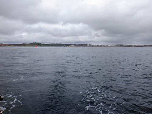
Friday, May 21, 2021

2021 Round GB Day 35. Raasay to Loch Carron.

The old pier on Rassay with Scalpay behind and Skye to the right. 
With strong northerly winds forecast for Thursday and Friday the aim on Wednesday was to find a good anchorage and hopefully have a good sail getting there. With my shortened chain I also preferred relatively shallow water, the problem round here is that a mountain to windward does not give much shelter and frequently they will generate sudden squalls and wind coming from different directions in quick succession, a good way to "unscrew" an anchor and drag.

I came up with upper Loch Carron, the anchorage off the village of Lochcarron is large, shallow and well sheltered from the north with mountains quite some distance away, shelter from the east is not as good but the fetch of water at high tide is about a mile and half a mile at low water. There is also a shop, garage, hotel and easy landing at a slip. So off I went.

Track from Churchton Bay to Upper Loch Carron
Not for the first time this cruise, after motoring out of the anchorage I continued with just the genoa, partly because the wind was likely to be gusty - I have sailed past Scalpay before - but also the narrow route into upper Loch Carron is twisty and, if the forecast panned out, likely to require a lot of gybing so as I had plenty of time and Sancerre sails very well under just the headsail, I took the easy option.

The wind was initially from the NE and I was hard on the wind past Scalpay to clear outlying rocks / Islets Sgeir Thraid &  Sgeir Dhearg then a peasant reach across the inner sound before coming to the wind again to enter Loch Carron. For about 20 minutes I put the engine on to pass through a narrow passage inside some rocks north of Plockton lighthouse which coincided with a drop in the wind as it swung round to the southwest, good timing for going up the narrows to the upper Loch. 
Sgeir Bhuidhe (left) and Sgair Goloach Islets in Loch Carron
as you go south towards Plockton
The entrance to upper Loch Carron through Strome Narrows.
My actual track both ways through Strome Narrows, I was
using the autopilot on a planned track which is as accurate as
GPS so the outbound track overlays the inbound and both are
dead straight.
That is a spectacular section passing within a few boat lengths of rocks and high cliffs, even more impressive than the pictures imply.
Achilles 9m Sancerre off Plockton
Bogha Dubh Sgeir about 3/4 mile NE of Plockton
Achilles 9m Sancerre off Plockton
Eilean a' Bhata on the other side of the channel.
Achilles 9m Sancerre in Strome Narrows
 A very pleasant sail that would have been excellent but for the still cold wind.

23 miles over the ground in 6 hours.

Slide show of all my pictures from Raasay to Upper Loch Carron, page through by clicking the arrows or click in the centre of the pic to view from Flickr in a new window or full screen:

Raasay to Upper Loch Carron


Thursday, May 20, 2021

2021 Round GB Day 34. Shieldaig to Raasay.

I sailed up the "Inner Sound" (east of Raasay) last year and the AUTEC submarine / underwater weapons systems range along there was likely to be active so I decided to take the slightly longer route south west of Rona and Raasay.

Achilles 9m Sancerre in Loch Shieldaig
Early morning in Loch Shieldaig.
Achilles 9m Sancerre in Loch Shieldaig
Leaving in a dead calm with the wake (some created by the
dinghy I was towing) reaching to each side of the Loch.
Achilles 9m Sancerre in Loch Shieldaig
Approaching the outer Loch.
Achilles 9m Sancerre in Loch Shieldaig
Moving into the outer loch, the shore is very steep too, here
I was in 134 metres of water (just visible on the instrument on
the right) and that continues to well less than 100 yards of the shore.
The water around Raasay and Rona is incredibly deep close to
shore, just north of Rona my echo sounder could not find the
bottom which the chart says is 265 metres down.
It was a day of fluky, generally light winds and when coming down the sound it took me 4 hours to cover just under 10 miles with no significant current and 6.5 hours to cover the 30 miles to Churchton Bay at the south end of Raasay. 
Approaching Rona moving from 250 metres of water to 50 or so.
Achilles 9m Sancerre in the Sound of Rassay
Beating down the Sound of Rassay.
I chose to anchor south of the small harbour to avoid disturbance from the ferry and anchored in front of Raasay House, now a hotel but a private house when Boswell & Johnson visited in 1773.
Churchton Bay, Raasay. Raasay House on the left.
The Isle of Skye from the anchorage.

Slide show of all my pictures from Shieldaig to Raasay, page through by clicking the arrows or click in the centre of the pic to view from Flickr in a new window or full screen:

2021 Round GB Day 33. Loch Ewe to Shieldaig.

Last year going north I skipped going into Loch Torridon as the weather was so dismal, this time I decided to give it a go and to go into the middle section known as Loch Shieldaig.

I left at 07:20 and after motoring out of the Loch I picked up a light breeze that lasted until about 09:30 when it dropped to less than 2 knots so on went the engine to get round Rusha Reidh. The wind came up shortly after and I was able to sail down to Red Point at the entrance to the Loch and a good way into it before the wind went again,.

I went to a very sheltered anchorage off of Shieldaig, close to the shore and behind a heavily wooded island. 

Out came the dinghy for a quick shopping trip and later for a meal at the local hotel, good food, adequate wine but expensive, the later stupidly so. That put a bit of a blight on what was otherwise a pleasant day.

Rubha (Point) Reidh lighthouse.
Even though I was within 10 miles of the centre of repeated
GPS jamming / spoofing trials with a "danger" area of 30 miles I
did not see any effects which must be very local and / or subtle
but this on radar looks suspiciously like jamming or interference
from one of the many grey painted ships in the area.
Approaching the entrance to the middle section of the Loch,
behind the black line with the block showing at the bottom.
I'll put more pics of this impressive entrance in the next post,
although the number may be limited by poor upload speeds,
 
Moving from Loch Torridon into Loch Shieldaig.
Achilles 9m Sancerre in Loch Shieldaig
Just short of the anchorage, the passage into the upper loch is
just right of centre. it was the 17th May and there were still a few
patches of snow visible.

 
Achilles 9m Sancerre in Loch Shieldaig
The island side of the anchorage. The isolated rock is part of a
reef blocking passage between the island and mainland to 
another anchorage on the other side.
Achilles 9m Sancerre in Loch Shieldaig

Achilles 9m Sancerre in Loch Shieldaig
The north side of the anchorage.

Achilles 9m Sancerre in Loch Shieldaig
Sancerre from the beach.

33.3 miles over the ground in 7.5 hours.

Slide show of all my pictures from Loch Ewe to Shieldaig, page through by clicking the arrows or click in the centre of the pic to view from Flickr in a new window or full screen:

 2021 Loch Ewe - Loch Shieldaig

Click here for Day 34, Shieldaig to Raasay.

2021 Round GB Day 32. On from Stornoway.

Beating south from Stornoway,
After a good nights sleep and a shower I found that on Sundays the Stornoway Co-op and other shops were closed (unlike in Stromness), that the forecast was reasonable through Wednesday but iffy from some time on Thursday and that the tide was good to get past the Shiant Islands where tides are significant, during the early afternoon.

So with some wind and more forecast I abandoned my planned rest day and at 10:30 headed out with the possibility of getting down the east coast with time to cross the Sea of the Hebrides to the mainland before the bad weather arrived.

That proved optimistic.

Almost as soon as I cleared the harbour the wind dropped and changed from an excellent north easterly to a dead beat. Then it started to drizzle, I was not happy.

By 14:15 I managed to get 3 miles from the harbour boundary covering all of 11 miles over the ground since leaving the marina. Also the latest forecast was not good. The chance of following "Plan B" was greatly diminished and there was a strong possibility of getting stuck at the southern end of the Outer Hebrides for an extended period - the crossing from there to the mainland crosses some difficult seas with strong tides and needs good weather.

I therefore decided to bail out to the mainland coast so that I could get to the sheltered waters behind the Isle of Skye, on went the engine and I headed for Loch Ewe the closest good anchorage.

"Plan C" as executed - Stornoway to Loch Ewe.
The Polish guided missile frigate ORP General K. Pulaski. A German
oiler behind. Ships of other nationalities including Dutch, French
and British were in the area.
I arrived at the Aultbea anchorage at 19:20 having covered 38 miles over the ground in 9 hours. 
The entrance to Loch Ewe (centre)
Achilles 9 metres Sancerre in Loch Ewe
The anchorage at 23:00, still over a month from the longest day.

2021 Stornoway - Loch Ewe

Click here for day 32, Loch Ewe to Shieldaig.

2021 Round GB Day 31. Loch Ned to Stornoway.

The weather forecast indicated that St Kilda would not be safe but a cruise down the east coast and a quick perusal of the Sound of Harris and the Sound of Barra could well be, so with good sailing weather I left for Stornoway at 06:45 and apart for a brief spell off the Point of Stoer I was able to sail in 10 - 15 knots of wind all the way once clear of the loch.

Achilles 9 metre Sancerre off the Old Man of Stoer
The Old Man of Stoer
Achilles 9 metre Sancerre off the Old Man of Stoer
The sea was a little lumpy.
Achilles 9 metre Sancerre off the Old Man of Stoer
Point of Stoer light
Off Point of Stoer looking towards Skye.
Achilles 9 metre Sancerre off the Stornoway
Stornoway
Achilles 9 metres Sancerre entering Stornoway harbour
The final approach into Stornoway Marina
Coming alongside at 15:45, "Flying Fox" last seen heading out to sea from Cape Wrath (see previous post) was already there. A local chippy provided my first meal on this trip not prepared on board.


47 miles over the ground in 9 hours.

Slide show of all my pictures from Loch Ned to Stornoway, page through by clicking the arrows or click in the centre of the pic to view from Flickr in a new window or full screen:

2021 Loch Ned - Stornoway